
The Gaumukh Tapovan trek follows the Bhagirathi river from Gangotri to Gaumukh, the snout of the Gangotri Glacier, and then climbs to Tapovan, a high meadow below the peak of Shivling. It is one of the most scenic Himalayan treks in Uttarakhand and also one of the more demanding, because of the altitude and the loose moraine near the glacier. This guide gives you the route, daily stages, rules and costs so you can plan it with confidence.
Gaumukh Tapovan at a glance
| Detail | Information |
|---|---|
| Start and end | Gangotri (about 3,415 m) |
| Highest point | Tapovan, about 4,460 to 4,500 m (sources vary) |
| Distance | Roughly 40 to 46 km round trip on foot (sources vary) |
| Duration | 5 to 6 days from Gangotri; 8 days if counted from Dehradun |
| Difficulty | Moderate to difficult |
| Best season | May to June and September to October |
The figures differ between operators, so treat them as a range and confirm with the agency that will take you.
Day-wise route
| Day | Stage | Distance | Time |
|---|---|---|---|
| 1 | Reach Gangotri, permit check, rest | Drive | Full day |
| 2 | Gangotri to Chirbasa (about 3,580 m) | 9 km | 4 to 5 hrs |
| 3 | Chirbasa to Bhojbasa (about 3,775 m) | 5 km | 3 to 4 hrs |
| 4 | Bhojbasa to Gaumukh to Tapovan (about 4,500 m) | 9 to 11 km | 7 to 8 hrs |
| 5 | Explore Tapovan, Nil Tal and the base of Shivling | Local | 4 to 5 hrs |
| 6 | Tapovan to Bhojbasa | 11 km | 7 to 8 hrs |
| 7 | Bhojbasa to Gangotri | 14 km | 6 to 7 hrs |
Gangotri to Chirbasa
The trail begins just past the Gangotri temple, enters the Gangotri National Park at a forest gate where permits are checked, and climbs gently above the river. It is a good first walk because it is short, and it lets your body adjust. Chirbasa is named after the chir pines that once grew there.
Chirbasa to Bhojbasa
The path goes through open slopes with views of the Bhagirathi peaks. Bhojbasa is named after the bhojpatra, the birch trees whose bark was once used for writing. There is a small forest rest house and a few camps. This is where most trekkers spend the night before going on to the glacier.
Bhojbasa to Gaumukh
The last stretch to Gaumukh is rough, with loose stones and the sound of ice breaking in the river. Gaumukh itself is the cave-like snout from which the Bhagirathi emerges. Many pilgrims take a dip or collect water here, which is a risk because the glacier front can collapse, so stay behind safe markers.
Gaumukh to Tapovan
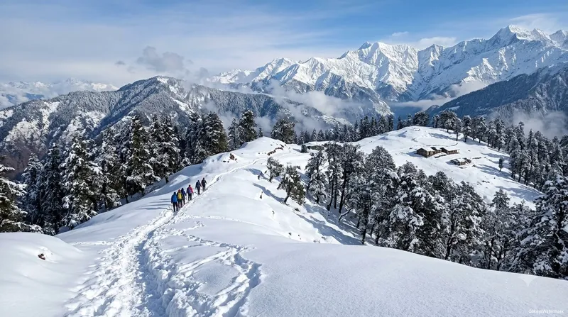
Beyond Gaumukh, the route crosses the glacier moraine, a field of boulders and ice, and then climbs steeply to the Tapovan meadow. The trail here is hard to follow, and a guide is required. Tapovan sits in the shadow of Shivling and has views of Meru, Bhagirathi and other peaks. Nil Tal and the Shivling base area are optional walks on the rest day.
Gaumukh only, or Tapovan too?
Gaumukh is a reasonable target for fit walkers who want the glacier and a pilgrimage feel. It takes two days up and one day down, with a night at Bhojbasa. Tapovan adds a tough climb and a night at the highest camp, and suits people with some experience at altitude. If you are not sure, go to Gaumukh, and decide on Tapovan after you feel how you cope with Bhojbasa.
Permit rules in brief
Permits are needed for the Gangotri National Park. As reported in trek guides, the daily cap is 150 permits on a first-come basis, Indian citizens pay a small per-day fee, foreign nationals pay a higher fee, and you need photo identification. Tapovan requires a guide from a registered agency, while Gaumukh needs only the permit. Drones and videography are not allowed in the park. Rules and fees are revised often, so use the steps in our Gaumukh permit guide, and confirm on the official portal before you travel.
Cost of the trek
Operators price a guided trek, including permits, camping, meals, guide and porter support, from around Rs 18,500 per person plus GST, and backpack offloading is usually extra. Doing it independently is cheaper, but you still need the permit, a guide for Tapovan, camping gear or rooms at Bhojbasa, and meals. Prices vary widely, so compare what is included, such as tents, sleeping bags, insurance and an emergency plan.
Best time for the Gaumukh trek
| Period | Conditions |
|---|---|
| April to early May | Cold, snow on the trail, early season |
| Mid May to June | Best weather, but busier |
| July and August | Monsoon, landslides, avoid |
| September to October | Clear skies, cold nights, popular |
| November to March | Closed, Gangotri itself shuts for winter |
Altitude and safety
The main risk is altitude sickness. Walk slowly, drink plenty of water and sleep at Bhojbasa before going higher. If you have a persistent headache, vomiting or breathlessness at rest, go down. Other precautions include a medical check before the trek, a warm sleeping bag, a rain cover, trekking poles and good shoes. Keep your pack near 12 kg, and carry all your trash back.
How to reach Gangotri
Gangotri is about 250 km from Rishikesh by road via Uttarkashi and Harsil, a drive of 9 to 10 hours. Spend a night in Uttarkashi or Harsil to break the journey. Read our Gangotri yatra guide for the temple and road, and consider a stay in Harsil using our Harsil valley guide. If you want a pilgrimage trip first, see our Gangotri and Yamunotri 5-day yatra.