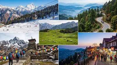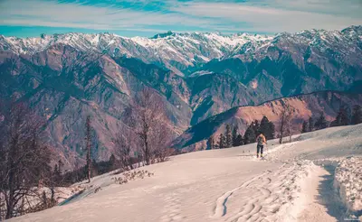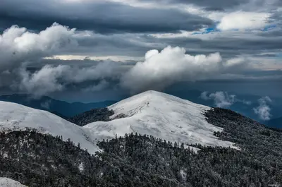

Niti Valley is a high, dry border valley in Chamoli district, and its weather is harder than most visitors expect. The valley runs for roughly 90 km from Joshimath towards the Tibetan border, and over that distance the climate changes from mild mountain slopes to a cold, thin-aired desert. This guide explains how the weather works along the valley, what each month is like, and how to choose a window that matches your plans.
Why Niti Valley weather is different from Joshimath and Auli
Most travellers know Joshimath and Auli, where the climate is a typical Himalayan mix of monsoon rain and winter snow. Niti sits behind the main Himalayan ranges. The Dhauliganga river valley climbs from about 1,900 m at Joshimath to roughly 3,600 m at the head of the valley, and the higher you go, the thinner the monsoon becomes and the colder the nights get. Summer days in the upper valley can be sunny and dry, while mornings are close to freezing.
The practical result is that the valley has two very different personalities. The lower part around Tapovan and Reni has a conventional hill climate. The upper part around Malari, Gamsali and Niti village has long, severe winters and a short, bright summer. Our Niti Valley travel overview describes the villages and what to see, and this guide does not repeat that.
The seasonal calendar at a glance
| Months | Season in Niti Valley | What it means for a trip |
|---|---|---|
| December to February | Deep winter, heavy snow in the upper valley | Villages mostly empty, road often blocked, not a tourist season |
| March | Late winter, slow thaw | Road clearing begins, conditions uncertain |
| April | Early spring, cold, patchy snow | Lower valley usually reachable, upper stretch depends on clearance |
| May | Start of the visiting season | Cool days, cold nights, road generally open |
| June | Early summer, driest and brightest weeks | Good for visiting |
| July to August | Monsoon on the lower route, lighter rain higher up | Landslide risk on the Joshimath highway, plan buffer days |
| September | Clear, crisp weather returns | One of the best months |
| October | Cold, very clear, first snow on high peaks | Good, but freezing nights |
| November | Winter arrives | Road may close without notice, villagers leave |
This table is a seasonal pattern and not a forecast. Official temperature records for the upper valley are thin, so we do not publish exact degree figures. As a rule, expect night temperatures near or below freezing for most of the year at the upper villages.
Month by month in more detail
December to February
This is the real winter. Snow settles on the valley floor, the Dhauliganga runs low and icy, and the Bhotiya families who live in the upper villages move down to lower areas such as Joshimath for the cold months. The road is routinely blocked by snow, and facilities such as homestays and shops are closed. If you want winter scenes, Auli and Joshimath are the sensible choices; see our Auli weather and snowfall guide.
March and April
Spring comes slowly. The border road agencies start clearing snow, usually from the lower end upwards. In April you may find clear roads as far as Malari and snow patches beyond. The sky is often sharply blue, but wind and cold nights make it uncomfortable without proper layers. Check the road condition with the Joshimath police or your driver before leaving.
May and June
These are the first comfortable months. Villagers begin to return, the apple and walnut trees in the lower villages leaf out, and the high meadows turn green. Days are warm in the sun and cold in the shade. June is usually the driest of the visiting months in the upper valley, though the first showers can arrive on the lower highway by the end of the month.
July and August
The monsoon mainly affects the route to the valley, not the valley itself. Heavy rain on the Rishikesh to Joshimath highway can cause landslides and long delays, and a short stretch of the valley road can wash out. Higher up, rain is lighter, and the flowers are in bloom. If you travel in these months, keep two spare days and avoid night driving.
September and October
Many local drivers call this the best time. The air is clear, the mountains are visible and the river is calmer. Nights are cold, and by late October snow can dust the higher peaks. Book your stay early, because the season is short and the villages start to close.
November
The season ends. The road can close after a single snowfall, and homestays shut as families leave. Treat November as a risky month for Niti and plan for Joshimath or Auli instead.
How to choose your window
- For a comfortable first trip: late May to mid June, or mid September to mid October.
- For flowers and green meadows: June to August, with extra buffer days for rain on the highway.
- For clear photographs: late September to October.
- For snow: do not choose Niti. Choose Auli or Chopta, which are easier to reach and have better facilities.
What to wear and carry
- Thermal base layers, a fleece and a down jacket, even in June.
- A windproof and waterproof shell.
- A cap, gloves and a scarf for early mornings.
- Sunscreen, lip balm and sunglasses, because the sun is intense at altitude.
- Walking shoes with grip.
- A power bank, as mobile network is patchy.
- Personal medicines and something for altitude headaches.
Altitude and health
The upper valley is above 3,000 m, so give yourself a night at Joshimath before going further. Drink water, avoid alcohol and do not push on if you feel dizzy or breathless.
Permits and border rules
The valley lies near the international border with china, so some areas need registration or permission. Rules change, so check locally before you travel. Our Nelong Valley permit guide explains how border permits work in Uttarakhand, and you should confirm the current requirement for Niti with the Joshimath administration.
Combine Niti with Auli and Chopta
Most travellers fold Niti Valley into a longer Garhwal loop. You can pair it with Joshimath, Auli, Chopta and Tungnath, as in our Auli and Chopta tour package. For the Auli leg, read the best time to visit Auli and Chopta.